Westspit Braddock Bay

Monday, October 27, 2014

NYS DEC Open Space Conservation Plan seeks your comments

Hurricane-Super-Storm Sandy has had a big effect on the State of New York, its politicians  and planners.  Built into the Draft NYS DEC Open Space Conservation Plan are strategies and priorities concerning coastlines.  

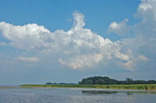
RIPARIAN BUFFERS, COASTLINE AND WETLAND PROTECTION PROJECTS AIMED AT REDUCING THE IMPACTS OF STORMS, STORM SURGES AND FLOODING ON HUMAN AND NATURAL COMMUNITIES {131.}
Open Space conservation programs and strategies that focus on protecting wetlands, floodplain, forests and coastlines should be our first line of defense to protect adjacent private property and communities from increased storm intensity, flooding and rising sea level. These natural resource based programs are usually far cheaper than “engineered” solutions that often shift negative impacts downstream or to adjacent property owners, as well as not being sustainable for the long term or protecting natural resources. As an added benefit, these programs can promote the resilience of
natural communities to climate change (for example, by enhancing aquatic connectivity, protecting cover along streams and lakes that serve as refuge for trout and other cold water fish species). Spatial modeling can inform where strategic investments in the protection of riparian and wetland areas through fee and easement acquisitions can promote more climate-resilient human and natural communities and should be used to prioritize protection projects.  

Do you have any comments to make?  Make sure to email to LF.OpenSpacePlan@dec.ny.gov  Comments must be received by December 17, 2014. 

Sunday, October 26, 2014

Ecohydrology issues are solved locally ... at the scale of the watershed

Salmon Creek Hilton NY
There is new thinking in the area characterized by 'ecosystems' which might be termed 'ecohydrology.' There are other terms as well including 'water nexus' which refer to the dynamics of land and water.

We're in a new, climate-shifting pattern of weather and its effects on earth. It is unmistakable, but we are players in this interaction and what we do counts.

"The solutions to the global water crisis can't be global," says Dr. Karen Bakker of the University of British Columbia's Program on Water Governance at the University's Institute for Resources, Environment and Sustainability. Dr. Bakker teaches an edX course, Blue is the New Green

"The solutions are necessarily local. They're going to operate at the scale of the watershed."  If that is the case, I have been watching the evolution of 'local' to mean 'superseded' by more and more agencies. For instance, what happened in legislation and agreements decades ago dictates today:  "Lakewide Management Plans (LaMPs) stem from the 1987 amendments to the Great Lakes Water Quality Agreement, originally signed by the United States and Canada in 1972. This historic agreement committed both countries 'to restore and maintain the chemical, physical and biological integrity of the waters of the Great Lakes basin ecosystem.' To meet this commitment, the two governments agreed to develop and implement LaMPs for open lake waters and Remedial Action Plans (RAPs) for specific geographic Areas of Concern (AOCs). LaMPs are intended to identify critical pollutants that affect beneficial uses of the lakes and to present strategies, recommendations and policy options to restore those beneficial uses. LaMPs for lakes Erie, Michigan, Ontario and Superior have been developed with guidance from the U.S. Environmental Protection Agency and Environment Canada. Through an iterative approach, these documents will be updated and re-released every two years to incorporate new data and public input."  Overlapping and confusing . . . . 

Saturday, October 25, 2014

"Restoration" the new buzz word for wetlands


Hunting in America is big business, generating more than $67 billion in economic output and more than one million jobs in the United States according to the International Association of Fish and Wildlife Agencies.  Read more about the economic impact of hunting: http://www.fishwildlife.org/files/Hunting_Economic_Impact.pdf

New York State is considered part of the Atlantic flyway in North America. Generally birds do not fly directly across Lake Ontario's 60 miles of open water, but skirt the edges.  

One of the most moneyed pockets of support for 'restoration of wetlands' is Ducks Unlmited, a national organization with 600,000 members and based in Tennesee. The DU members are hunters who believe in conservation and now 'restoration' of wetlands.  Buoyed by the hundreds of millions of dollars being handed out by the Great Lakes Restoration Initiative, DU has been awarded grants in New York State.

Among the projects funded by GLRI is one located at Braddock Bay.  "The conservation methods proposed at Braddock Bay FWMA and Lake Shore Marshes WMA [eastward to Oswego area along L. Ontario] have been successfully implemented in other parts of the Lake Ontario basin to improve fish and wildlife habitat. Preliminary results of projects on French Creek WMA, Lakeview Marshes WMA, and on private lands in Jefferson County show positive ecological benefits from channel and pothole excavation in cattail stands," says Ducks Unlimited.  

"DU received funding for this project through the Great Lakes Restoration Initiative, North America Wetlands Conservation Act, and private donations from Constellation Energy. Partners include the U.S. Fish and Wildlife Service, New York Department of Environmental Conservation, National Oceanic and Atmospheric Administration, Great Lakes Basin Fish Habitat Partnership, Fresh Water Futures, Friends of Montezuma Wetlands Complex, Montezuma Audubon, Town of Greece, the Nature Conservancy, Braddock Bay Fish and Wildlife Management Area Committee, Town of Greece Parks, and Lake Plains Waterfowl Association."  Read more about what DU is pushing in NYS: http://www.ducks.org/new-york/du-to-restore-lake-ontario-wetlands-in-new-york

Wednesday, October 22, 2014

Residents of Braddock Bay hear little of project details; questions remain


About 300 residents attended a meeting at the Greece Town Hall Oct. 22 at which a spokesman from the Army Corps of Engineers talked about a proposed project which would place a permanent breakwall across a portion of Braddock Bay extending from the eastern side into the mouth of the bay.  

Expert Doug Wilcox, professor at SUNY Brockport, stated that Braddock Bay had a 'barrier beach' long ago, but upon questioning, could not point to a photograph or map that showed a barrier beach across the mouth of the bay.  It was the presence of this 'barrier beach' that kept the wetland healthy asserted Mr. Wilcox and this was backed up by the Army Corps representative who pointed to the 'erosion of the barrier beach' as the reason for the breakwall construction.  NOTE: THE US ARMY CORPS in Buffalo 'thinks' that there was a 'barrier beach' across Braddock Bay: "The barrier beach will be restored  ?? What if there NEVER was a 'barrier beach'?? 
Lines courtesy US Army Corps/Buffalo
Braddock Bay-Is this correct? 
Fisherpeople say 'no.' Bay looks 
today like it did 30 years ago:
"Hunting blinds are still in exactly 
the same place against shoreline,"
- Bay hunter.

"The barrier would never have completely blocked off the bay from the lake because Salmon Creek water has to reach the lake," Professor Wilcox said in a correspondence after the public meeting.  "As I have been told by others, the trolley line used the barrier as the foundation to follow in crossing the bay, like Edgemere Drive uses the barrier as its foundation. Loss of the barrier beach is the hydrologic change that has affected the bay.  With no barrier, sand in the littoral drift is able to sweep into the bay.  With no barrier, wave action keeps water in the bay turbid."  Huh? Don't you want to keep the bay 'turbid' to retain marshland which is built by sedimentation?

Additional questioning by residents to Mr. Wilcox about how the War of 1812 brigantines entered Braddock Bay harbor brought shrugs on the part of  the professor.  Apparently there was an adequate channel at one time through which deep water boats entered.  Subsequently in the late 1800s the now-submerged Manitou Trolley foundation was built entirely across the mouth of the bay and the rails were suspended over the bay on pilings. The trolley foundation still remains and serves as a natural barrier beach for the bay.

Representatives from the EPA, the Rochester Embayment and other agencies were available to answer questions, but there was no public Q & A.  To make a public comment to the US Army Corps, go to the contact on the Army Corps website: http://bit.ly/BraddockBay or to the EPA: Fred Luckey (luckey.frederick@epa.gov212-637-3853  or  Brenda Jones (jones.brenda@epa.gov312-886-7188, both of whom were at meeting.

Tuesday, October 14, 2014

Braddock Bay - Public Hearing Oct. 22, 2014 @ Greece NY Town Hall

Public is encouraged to attend: Wednesday, Oct. 22, 2014, 6:30 pm Town Hall, Greece, Long Pond Rd. -- US. Army Corps/Town of Greece want to permanently block half the mouth of Braddock Bay. Be there!!  Don't underestimate the importance of the Bay and any major alterations to its hydrology. Braddock Bay is a freshwater estuary . . . defined as a 'semi-enclosed area where combinations of river/creek and lake water mix and are storm-driven.' In the Great Lakes, the water level changes due to a seiche ['sloshing about' of Great Lakes] which also mixes water from inflow and lake.

My opinion: The Bay is much more fragile than the Town of Greece and the Army Corps are giving it credit for. The Bay can and will turn into a muck hole if a permanent breakwall barrier is placed at its mouth. The Bay is 10,000 years old and it is the only one of the five water features in the DEC Management Area with two major incoming watersheds that drain directly into the bay: Salmon Creek and Buttonwood Creek. It is the only water feature in the WMA with an incredible hydrologic feature, the west spit, which dives underwater and is reinforced by the 100-year old Manitou Trolley foundation which extends across the entire mouth of the bay. It is this old underwater foundation that is working positively for the bay's health. The wave action from storms coming in from all directions combined with the creek inflow make it a rich bay and yet, still quite fragile. Fisherpeople on the Bay tell me to 'keep the channel dredged' -- 'don't obstruct the mouth with a cement barrier.' I am knowledgeable of almost every different kind of beach and man-made barrier, pier, jetty, break wall, etc. that can be built as I have surfed and dove off the coast of California and Mexico. I will predict that this permanent barrier will destroy the bay. Water has the last say. Water flow and wave action actually are our greatest asset in protecting the continued existence of the Bay. There is not one reason to mess with this natural hydrology unless you 'want to play god' and cause an increased level of silt, sand and encroaching vegetation to kill the bay as we know it. - Barbara Carder, 330 Manitou Beach Rd., Hilton, NY 14468


Saturday, October 11, 2014

Natural barriers, sandbars . . . . don't ignore their beauty and function


Wikimedia
Why should it matter that our Braddock Bay has a strong sandbar at its mouth, strengthened 100 years ago by the Manitou Trolley foundation?  Look at Japan's two-mile-long Amanohashidate sandbar on Miyazo Bay, a dynamically-stable sandbar. Considered a national treasure, the sandbar continues to be stable over the tens of centuries. A spit such as Braddock Bay's 'Westspit" is defined as a 'deposition landform' - connecting to a head and one end and a 'nose' at the other, it is formed when longshore drifting [or littoral drift] waves meet the beach at an oblique angle moving sand along in a zigzag pattern.  Braddock Bay's Westspit is a beautiful phenomenon.  Channel markers and a dredged channel permit vessels access. NYS's DEC agrees: http://www.dec.ny.gov/outdoor/24428.html 

NOTE: the older sandbar has closed off the mouth of several ponds. Braddock Bay is the only one left with healthy hydrology.  Photographer David Beadling has caught the Bay perfectly: http://www.braddockbaygallery.com/braddockbay.htm


Scientists have intensely studied shoreline morphology [form and structure]: "Sandbars play an important role in beach stability since they reduce the energy of waves by breaking them, thereby preventing severe erosion . . . such dynamically stable sandbars effectively contribute to disaster mitigation . . . ." American Geophysical Union, Fall Meeting 2013, abstract #EP13A-0826


Sunday, October 05, 2014

Don't Turn Braddock Bay into a Muck Hole

View from east; Salmon Ck. at top. 
Notice the natural hydrology of the  Bay


WHAT: One of the few bays and marshland complexes on the southern shore of L. Ontario in NYS which is and has been holding its own for over ten thousand years!! 


ALERT: How much science and how much politics are involved in the proposed Army Corps project which is slated to place a permanent barrier across half of the mouth of Braddock Bay, part of the 2,600-acre Braddock Bay Wildlife Management Area managed by NYS Department of Environmental Conservation.  

Yet, the Town of Greece has long had its eye on "Shoreline Protection" in its LWRP [Local Waterfront Revitalization] https://greeceny.gov/files/23~Chapter%205-Proposed%20Projects.pdf: "Construct a shoreline protective feature at Braddock Bay to PROTECT THE SENSITIVE SHORELINE from continued recession and to restore historic sedimentation patterns to the bay."  Read: cement breakwall and nod to property owners - even though there is no residential property on the baymouth area.

HOW BRADDOCK BAY [WHICH IS IN THE SALMON CREEK WATERSHED] GOT LUMPED WITH THE GENESEE  RIVER [ROCHESTER EMBAYMENT']; clue - it's about getting $$: 
http://www.epa.gov/glnpo/lakeont/2013/201308-lamp-ontario.pdf

WHO IS PUSHING THIS US Army Corps Project through and why: GET THE FACTS: http://www.epa.gov/glnpo/aoc/rochester/index.html  This project is being encouraged by NY Senator Chuck Schumer:  http://www.schumer.senate.gov/record.cfm?id=350539& the EPA funded the US Army Corps of Engineers out of Buffalo to ostensibly [and in report] "reduce erosion of the existing emergent marsh."-- Yet everyone can see, the cattail marsh is encroaching -- not eroding the bay http://www.lrb.usace.army.mil/Missions/CivilWorks/DistrictProjects/BraddockBay.aspx  Read the "Feasibility Study": http://cdm16021.contentdm.oclc.org/cdm/compoundobject/collection/p16021coll7/id/910/rec/5

RED FLAG:  proposed $9M funding via the EPA with Great Lakes Regional Initiative for the Army Corps might effectively destroy the bay.  Don't underestimate how massive this barrier is: http://www.lrb.usace.army.mil/Portals/45/docs/BraddockBay/Braddock-Bay-Poster02.pdf

WHY: The hydrology the Bay works to keep it alive due to both wave action and incoming creeks - Salmon Creek and Buttonwood Ck.  A natural barrier already exists at the mouth of the bay: the submerged 100-year-old foundation of the trolley bed which is locally called "The West Spit". This has an ameliorating effect on the storms coming in from all directions. The hydrology the bay is working to keep it alive due to both wave action and incoming creeks - Salmon Creek and Buttonwood Ck. A barrier will permanently alter this hydrology negatively. 

NOT being taken into account:
  • Why not consider existing rip-rap rock barrier on eastside extension of Edgemere Dr. along old trolley bed as your primary 'stabilizing' structure rather than extending anything into mouth of bay. Proposed barrier [concrete headland] will have detrimental effect if you take into consideration the silt, etc. from Buttonwood, Salmon creeks and tributaries as well as year-round wave action coming in from Lake Ontario -- including winter storms piling up sand at least a mile out onto west spit and its extension underwater across mouth of bay;
  • Don't keep moving the sand/dirt from the old Manitou trolley foundation on the westside [as is being done now by 'testing'] as it provides a natural, wave-endured barrier and without it, more sand, silt will enter the bay proper;
  • Think of the west spit as a natural habitat resource --- the spit is both underwater and extends into upland maintaining a less severe wave action coming in from westerly, northwesterly and northerly storms -- keep that there!
  • Find out from Montezuma if 'potholes' work or are just immediately filled in by invasives -purple loosetrife -- you could make the bay marsh worse!  Cattails and bull rush have been in the bay and ponds forever, but still, the Great Lakes Restoration Initiative wants to 'clean it up' and even funded Ducks Unlimited for $499,627.00 to do just that!!  
  • Realize that there NEVER will be habitat renewal in the bay proper -- ONLY THE UPSTREAM WATERSHED -- because of the water level 'up and down' of L. Ontario due to St. Lawrence Seaway and Ontario Hydro at Niagara Falls --- it will always be cattail -- better than MUCK!
"Just dig or dredge the channel -- that's it -- that's all we're asking" - Long-time fisherman and resident on Bayview Dr. on Braddock Bay.