Westspit Braddock Bay

Sunday, March 27, 2016

Braddock Bay 'Restoration' Final Design ~ US Army Corps


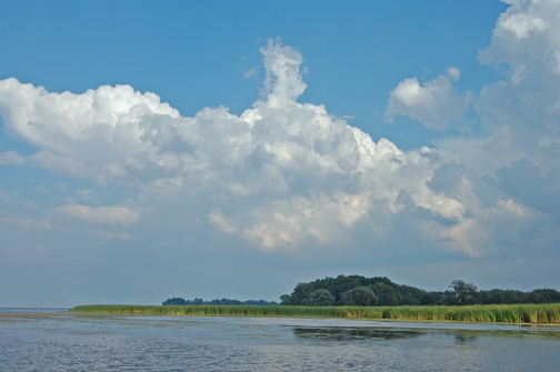
Braddock Bay is located on the shore of Lake Ontario in the town of Greece, NY and is part of the Rochester Embayment Great Lakes Area of Concern (AoC).  Over the last one hundred years, due to wave driven erosion, there has been a gradual loss of the protective barrier beach  as well as a loss of approximately 106 acres of wetlands. Also, since Lake Ontario water level regulation began in  1954, decreased fluctuations in water levels have resulted in the growth of a cattail monoculture and the loss of diverse habitat that once existed.

Study Overview: 

The U.S. Army Corps of Engineers, Buffalo District has completed a feasibility study to identifying a plan for ecosystem restoration at Braddock Bay, Monroe County, NY. The goal of restoration is to improve habitat diversity of the existing emergent marsh currently dominated by cattail, and to reduce erosion of the existing emergent marsh. The black tern was chosen as a target species for habitat restoration, because it represents a historic habitat no longer present in the bay. This habitat, characterized by diverse aquatic vegetation zones, sedge grass meadows, and open water areas interspersed within a matrix of emergent marsh, will be significantly more ecologically diverse than the existing cattail dominated emergent wetland and would provide high quality habitat for many species of fish and wildlife including American mink and northern pike. The proposed project supports delisting of the Rochester Embayment Area of Concern (AOC) Beneficial Use Impairment (BUI) for  loss of fish and wildlife habitat.

Contact Information

U.S. Army Corps of Engineers, Buffalo District
1776 Niagara Street
Buffalo, NY 14207
Telephone: 1-800-833-6390 (option 3)
Fax: 716-879-4434
Email: braddock.bay@usace.army.mil

Written comments should reference Braddock Bay Application # 2015-00095 and can be mailed to:
US Army Corps of Engineers, Buffalo District
(Attn:) Kathleen Buckler
1776 Niagara Street
Buffalo, NY 14207


Tuesday, March 22, 2016

2015 had the lowest abundance of yearling alewife in the 39 years it has been recorded

Biologists, anglers talk state of Lake Ontario fishing

PREV
Item 1 of 2
NEXT
GORDON BLOCK / WATERTOWN DAILY TIMES
Anglers listen to a presentation on Tuesday night in Pulaski about the status of fishing in Lake Ontario. The DEC said the 2015 had historically low fishing quality rates for sport fish like Chinook salmon, brown trout, rainbow trout and coho salmon.
PULASKI NY — The anglers knew it, and the biologists had the charts to confirm it: last season’s fishing on Lake Ontario was officially lousy.
With few answers about the cause of the dip, beyond colder-than-average water, there was little hope the state Department of Environmental Conservation could offer for fishing this year.
“I wish we had the answers, but we don’t have all the reasons why,” said David K. Lemon, the DEC’s Region 7 fisheries manager.
Among the DEC’s statistics presented during a meeting at Pulaski High School on Tuesday night was that the 2015 combined fishing quality, representing fish caught per hour on a charter boat, of chinook salmon, brown trout, rainbow trout and coho salmon were at the lowest levels recorded since 2002, and about 16 percent below long-term averages.
Individually, chinook salmon fishing quality was down 26 percent from the 2003-2015 average, coho salmon were down 57 percent from average, while the brown trout was down 27 percent from average. Rainbow trout was down 39 percent from the average. Rates of lake trout and Atlantic salmon were the main fish listed that did not see major drops, according to the DEC .
Anglers told the Times last fall that the bass fishing season was the worst they’d seen in years. 
DEC aquatic biologist Jana R. Lantry said water temperatures this past year were about 15 to 20 degrees below averages recorded from 2004 to 2013.
The wide-ranging meeting also covered preseason catch-and-release fishing, stocking plans and regulation proposals for the new year.
The statistics presented on Tuesday formalized what many local guides already knew. At least 100 people attended the meeting, many with business ties to the lake area. Anthony J. Gulisano, a Pulaski-based fishing guide on the Salmon River for about 25 years, said the last two years have been “nothing but crap.”
“We’ve seen the highs and lows, but this is extreme,” he said.
That dip in activity had a direct impact on the bottom line of guides like William and Rebel Gravelle.
“A lot of the guides lost business,” Mrs. Gravelle said.
Mr. Gravelle said his and other guides’ businesses were boosted by people flying in from out of state to fish.
The guides “were telling them don’t come,” he said. Among the biggest items of interest for biologists is the count of alewife, an important prey fish in the lake. The DEC said 2015 had the lowest abundance of yearling alewife in the 39 years it has been recorded.
Maureen Walsh, a research fishery biologist with the U.S. Geological Survey, said that though there is a small buffer from past years, the size of the new class was very important to the lake. She and other researchers will be conducting their annual review of the fish’s population in April.
“That will be very telling, how they survived,” she said.
A final DEC analysis of last year’s fishing is expected to be finished this spring. The preliminary DEC summary of 2015 fishing can be found at http://wdt.me/dec-fish.

Sunday, March 20, 2016

EPA is funding Braddock Bay 'construction' and 'channeling/potholing' to delist Rochester Embayment AOC

EPA Region 5 Project Title: COORDINATION OF THE DELISTING PROCESS FOR THE ROCHESTER EMBAYMENT AREA OF CONCERN


Hide details for Grant InformationGrant Information

Grant ID Number:GL - 00E01373-0
EPA Region:EPA R5AAShip:R05 - Region 5
Division/Office:Great Lakes National Program OfficeLab/Office:
CFDA:66.469Media:Water
Grant Program: 
Authority: 
Recipient Name: County of Monroe
City:Recipient Type:County
State:NYCong District:25
DUNS:079678249
Competition Status:
Award Date:09/22/2014Cum Award:$100,000
Project Start:10/01/2014Project End:09/30/2016

Hide details for Project Title & DescriptionProject Title & Description
COORDINATION OF THE DELISTING PROCESS FOR THE ROCHESTER EMBAYMENT AREA OF CONCERN

https://yosemite.epa.gov/oarm/igms_egf.nsf/52f35d81cc937e5e85256fb6006df28e/982234d9ed2cedd985257d6f007160e1!OpenDocument#_Section4

This project supports the Great Lakes Restoration Initiative (GLRI) and the Great Lakes Water Quality Agreement, pursuant to Public Law 113-76. Monroe County will continue to coordinate the implementation of the Rochester Embayment Remedial Action Plan (RAP). Key components of this project include (1) tracking and documenting remedial activities and progress towards delisting by means of update and annual reports and delisting documents; (2) coordinating RAP public participation, especially invigoration of the RAP Oversight Committee to reach consensus on progress towards endpoints for Beneficial Use Impairments, and informing the public on the delisting processes and successes while soliciting feedback on attitude toward the process, (3) coordination and integration of the RAP process with other Lake Groups such as the Lake Ontario Lakewide Action and Management Plan Committee and the International Joint Commission, (4) participation in drafting Beneficial Use Impairment delisting documents, culminating in a completed Stage III RAP except for incorporation of post management action monitoring, with at minimum a designation of the Rochester Embayment as an Area in Recovery and potentially the complete delisting of the Embayment, (5) participation in the review and monitoring of proposed management actions and subsequent monitoring efforts conducted by the agencies responsible for the management action.


Hide details for Contact InformationContact Information
RoleNamePhone
Project OfficerFrederick Luckey212-637-3853
Grant SpecialistFrancisca Ramos312-886-5945

Ever wonder what's behind decision-making? Look at this can of worms

EPA in bed with Army Corps since 2008: 'Compensatory Mitigation' - Section 404 permits through Clean Water Act

Compensatory Mitigation - An EPA/Army Corps thing

This page provides updates and background information regarding Clean Water Act Section 404 Compensatory Mitigation Requirements.

https://www.epa.gov/cwa-404/compensatory-mitigation

In 2008, EPA and the U.S. Army Corps of Engineers jointly promulgated regulations revising and clarifying requirements regarding compensatory mitigation.  According to these regulations, compensatory mitigation means the restoration (re-establishment or rehabilitation), establishment (creation), enhancement, and/or in certain circumstances preservation of wetlands, streams and other aquatic resources for the purposes of offsetting unavoidable adverse impacts which remain after all appropriate and practicable avoidance and minimization has been achieved.
Under the regulations, there are three mechanisms for providing compensatory mitigation (listed in order of preference as established by the regulations): mitigation banksin-lieu fee programs, and permittee-responsible mitigation.
On this page:

Compensatory Mitigation Regulations


Compensatory Mitigation Guidance


RIBITS (Regulatory In-lieu fee and Bank Information Tracking System)

RIBITS was developed by the U.S. Army Corps of Engineers with support from EPA and the U.S. Fish and Wildlife Service to provide better information on mitigation and conservation banking and in-lieu fee programs across the country. RIBITS allows users to access information on the types and numbers of mitigation and conservation bank and in-lieu fee program sites, associated documents, mitigation credit availability, service areas, as well information on national and local policies and procedures that affect mitigation and conservation bank and in-lieu fee program development and operation.

Compensatory Mitigation Factsheets

  • 2012 A Function-Based Framework for Stream Assessment & Restoration Projects, EPA 843-K-12-006 (PDF) (344 pp, 8MB) – This report lays out a framework for approaching stream assessment and restoration projects that focuses on understanding the suite of stream functions at a site in the context of what is happening in the watershed.  It has been developed to:
    1. Help the restoration community understand that stream functions are interrelated and generally build on each other in a specific order, a functional hierarchy, and understand that parameters can be used to assess those functions even if some parameters are functions and others are structural measures.
    2. Place reach scale restoration projects into watershed context and recognize that site selection is as important as the reach scale activities themselves.
    3. Provide informal guidance and ideas on how regional stream assessment procedures might incorporate stream functions into debit/credit determination methods, function-based assessments and performance standards.
  • 2012 UPDATED Natural Channel Design Review Checklist, EPA 843-B-12-005 (96 pp, 32MB) – This checklist and supporting document has been updated with supplementary materials and has been reformatted. It provides guidance on important items to consider when reviewing natural channel designs. It is intended to provide the reviewer with a rapid method for determining whether a project design contains an appropriate level of information for review and evaluation. Updated Excel spreadsheet version of Checklist 
  • 2011 Appalachian Stream Mitigation Workshop – The workshop included presentations designed to inform state and federal regulatory and resource agencies, who review, comment on and/or approve compensatory mitigation plans for surface coal mining projects in Appalachia. Additional information on the workshop, the presentation materials, and additional resources are provided.
  • 2010 Stream Mitigation Protocol Compendium, EPA 843-S-12-003 (155 pp, 1MB) - This report provides a review of 32 stream assessment protocols and mitigation guidance documents in use by various federal and state government agencies nationwide. It identifies stream functions or conditions assessed, parameters or attributes measured, assessment results obtained, intensity of effort and training needed, use and source of reference condition information, and other factors potentially instructive to parties seeking to review, initiate, or modify stream assessment programs.
    • APPENDIX A (10 pp, 81K) Hydraulic Regional Curves for Selected Areas of the United States
    • PART II (79 pp, 532K) Reviews of Representative Stream Assessment and Mitigation Protocols